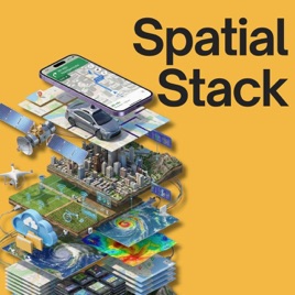
Advertise on podcast: Spatial Stack with Matt Forrest
Rating
5from
This podcast has
38 episodes
Language
EnglishPublisher
Matt ForrestExplicit
No
Date created
2024/05/28
Latest episode
2026/02/04
Average duration
42 min.
Release period
10 days
Description
Welcome to The Spatial Stack, where modern geospatial technology takes center stage. Our episodes feature interviews with leading experts, insightful discussions on the integration of AI and big data in spatial tech, and case studies on groundbreaking projects worldwide. Tune in to stay ahead in the rapidly evolving world of geospatial technology!
Unlock Spatial Stack with Matt Forrest podcast Email contact info,
Listeners & Audience details
Email contact information
Direct podcast contact details

Listeners
Audience numbers & engagement insights

Audience details
Podcast Insights

Podcast episodes
Check latest episodes from Spatial Stack with Matt Forrest podcast
#39: Why Geospatial Needs the Lakehouse with Damian Wylie
2026/02/04
There are trillions of dollars invested in the physical world every da: infrastructure, supply chains, and our planet.Yet many of these massive decisions are made without the data to back them up. For too long, geospatial analytics has been gated behind specialized teams and siloed technology, treated as "spatial is special" rather than just another data type.In this episode, we sit down with Damian Wiley from Wherobots to break down how cloud architecture is finally closing this gap. With a heavy-hitting background from AWS EC2 and Databricks, Damian explains the shift from transactional databases to the Lakehouse architecture and why "Zero ETL" is the holy grail for data engineering. We dive deep into why spatial data shouldn't be gated, how open table formats like Iceberg are changing the game, and why the future involves AI agents that can directly query the physical world.If you are a data engineer, developer, or leader looking to unlock location intelligence without the headache of complex infrastructure, this conversation is for you.✅ Sign Up for Wherobots: https://wherobots.com/✅ Learn more about Apache Sedona: https://wherobots.com/apache-sedona/✅ What is Apache Sedona: https://wherobots.com/blog/what-is-apache-sedona/✅ Test out SedonaDB: https://sedona.apache.org/sedonadb/latest/✅ Connect with Jia on LinkedIn: https://www.linkedin.com/in/wyliedamian/00:00 - The Trillion Dollar Data Gap: Investing in the physical world without intelligence 02:15 - From AWS EC2 to Geospatial: Damian’s journey from cloud infrastructure to spatial data 06:40 - "Spatial is Special" No More: Breaking down silos and making spatial data "just data" 09:00 - The Lakehouse Advantage: Decoupling storage and compute for economic agility 12:15 - Fragmented History: Why geospatial tech became so compartmentalized 17:30 - Real-World Impact: Optimizing supply chains and climate response with frequent data 22:45 - The Economics of Analytics: Lowering the Total Cost of Ownership (TCO) for pipelines 28:30 - AI Agents & The Physical World: Connecting LLMs to ground-truth reality 37:00 - Compute Strategy: When to use OLAP vs. OLTP for spatial workloads 46:00 - Zero ETL & The Future: How Iceberg and open standards enable interoperability 51:20 - Getting Started with SedonaDB: Vibe coding and the future of spatial queries📰 Daily modern GIS insights: https://forrest.nycCONNECT WITH ME📸 Instagram: https://www.instagram.com/matt_forrest/💼 LinkedIn: https://www.linkedin.com/in/mbforr/📧 Newsletter: https://forrest.nyc🌐 Website: https://forrest.nyc
#38: How Apache Sedona Solved Big Data’s Hardest Problem with Jia Yu
2026/01/29
Large Language Models can write poetry and debug code, but they still don't understand the fundamental physics of the real world. Ask an AI to find the "nearest restaurant" to a specific coordinate, and it struggles because it lacks Spatial Intelligence.
In this episode, we sit down with Jia Yu, the co-creator of Apache Sedona and co-founder of Wherobots, to discuss why geospatial data breaks standard big data engines and how he built the solution that now powers over 2 million downloads a month.
We trace the 10-year journey from a PhD research paper to a top-level Apache project, diving into the deep technical challenges of distributed computing. Jia explains why spatial data requires a completely different architecture than standard text or numbers and how the industry is finally moving toward a "Spatial Lakehouse" to break down data silos.
In this episode, we explore:
- The "Multimodality" Trap: Why mixing vector, raster, and LiDAR data crashes traditional systems.
- How SedonaDB is bringing massive scale to single-node machines (so you don't always need a cluster).
- The hardest problem in distributed computing - How to split a map across 1,000 servers without breaking the data.
- The multi-year fight to get native geometry support into Apache Iceberg.
- Why the next generation of models must evolve from text-based to spatially intelligent.
✅ Sign Up for Wherobots: https://wherobots.com/✅ Learn more about Apache Sedona: https://wherobots.com/apache-sedona/✅ What is Apache Sedona: https://wherobots.com/blog/what-is-apache-sedona/✅ Test out SedonaDB: https://sedona.apache.org/sedonadb/latest/✅ Connect with Jia on LinkedIn: https://www.linkedin.com/in/dr-jia-yu/
00:00:00 - Intro & Welcome 00:00:51 - The Origin Story: From GeoSpark to Apache Sedona 00:06:03 - Why Geospatial Data is "Special" (The Multimodality Problem) 00:09:47 - When to Move to Distributed Computing? 00:13:21 - The Secret to Maintaining a Vibrant Open Source Community00:18:11 - The Features That Drove Adoption: Spatial SQL & Python 00:22:35 - Deep Dive: How Spatial Partitioning Works 00:28:57 - Why Build a Cloud-Native Platform? 00:33:05 - The Rise of the Spatial Lakehouse & Apache Iceberg 00:40:17 - Introducing SedonaDB: A Single-Node Engine 00:45:10 - The Future: Why AI Needs Spatial Intelligence 00:48:44 - Advice for Getting Started with Spatial Engineering
📰 Daily modern GIS insights: https://forrest.nyc
CONNECT WITH ME📸 Instagram: https://www.instagram.com/matt_forrest/💼 LinkedIn: https://www.linkedin.com/in/mbforr/📧 Newsletter: https://forrest.nyc🌐 Website: https://forrest.nyc
The Hidden History (and Flaws) of the Zip Code
2026/01/23
In 1963, the US Postal Service introduced "Mr. Zip" to make mail delivery faster. They never intended for those five digits to determine your insurance premiums, your home value, or your health outcomes.
In this short deep-dive, we explore how an arbitrary logistical tool became a shorthand for community and why that’s dangerous. From the misleading boundaries of Dallas, Texas, to the tragic data failures during the Flint water crisis, we uncover the real story behind the map.
Listen in to learn why it's time to move beyond the zip code and start looking at the details that actually matter.
---
Whenever you’re ready, here are 3 ways I can help you:
🎓 Modern GIS Accelerator: The step-by-step roadmap to master Python, Spatial SQL & Cloud workflows. Stop just "making maps" and start building spatial solutions. 👉 https://forrest.nyc/accelerator/
🧪 The Spatial Lab: Join the top 5% of geospatial professionals in our private community. Get access to exclusive courses, mentorship, and the network you need to level up. 👉 https://forrest.nyc/spatial-lab/
📰 Daily modern GIS insights: https://forrest.nyc
CONNECT WITH ME📸 Instagram: https://www.instagram.com/matt_forrest/💼 LinkedIn: https://www.linkedin.com/in/mbforr/📧 Newsletter: https://forrest.nyc🌐 Website: https://forrest.nyc
#37: From Static Maps to Living Systems: How AI Is Changing Global Mapping with Cliff Allison from TomTom
2026/01/21
Maps have been around for thousands of years, but what they represent and how they work is changing faster than ever.
In this episode, I’m joined by Cliff Allison, who has spent more than 30 years building enterprise-scale mapping systems for governments and global organizations. Today, he leads government global sales at TomTom, helping bring modern, AI-powered mapping infrastructure to some of the most demanding use cases in the world.
We talk about how maps have evolved from static snapshots into living systems that update continuously, how open standards and collaboration made global mapping possible at scale, and why machines are now increasingly interacting with maps and with each other.
We also explore what this shift means for defense, intelligence, humanitarian response, and decision-making, and why mapping is no longer just a visualization layer, but a foundational system for understanding and predicting the world.
If you work in geospatial, data, AI, or infrastructure, this conversation will change how you think about maps.
---
Whenever you’re ready, here are 3 ways I can help you:
🎓 Modern GIS Accelerator: The step-by-step roadmap to master Python, Spatial SQL & Cloud workflows. Stop just "making maps" and start building spatial solutions. 👉 https://forrest.nyc/accelerator/
🧪 The Spatial Lab: Join the top 5% of geospatial professionals in our private community. Get access to exclusive courses, mentorship, and the network you need to level up. 👉 https://forrest.nyc/spatial-lab/
📰 Daily modern GIS insights: https://forrest.nyc
CONNECT WITH ME📸 Instagram: https://www.instagram.com/matt_forrest/💼 LinkedIn: https://www.linkedin.com/in/mbforr/📧 Newsletter: https://forrest.nyc🌐 Website: https://forrest.nyc
#36: Why Flood Risk Data Exists (But Isn’t Easy to Access) with Kevin Bullock
2026/01/08
We have an incredible amount of public geospatial data—high-resolution elevation, weather forecasts, floodplain maps, real-time sensors—yet most people still can’t easily answer a simple question:
“What’s my flood risk right here, right now?”
In this episode, I’m joined by Kevin Bullock, an aerospace engineer and remote sensing expert at Development Seed, to talk about how he turned years of geospatial expertise into Hydra Atlas, a mobile app designed to make flood risk understandable and accessible for everyday users.
We explore why so much critical data remains difficult to use, how Kevin pulled together datasets from FEMA, NOAA, and USGS, and why mobile—not web—was the right platform for this problem. Kevin also shares what it was like building a geospatial app with Swift, testing real-world use cases, and designing an interface that prioritizes clarity over complexity.
This conversation goes beyond flooding. It’s about modern GIS, product thinking, open data, and what happens when geospatial professionals stop building tools for other experts and start building tools for people.
If you’re interested in geospatial product development, public data, mobile mapping, or turning complex systems into usable software, this episode is for you.
Download HydraAtlas: https://apps.apple.com/us/app/hydraatlas/id6749492232Follow Kevin on LinkedIn: https://www.linkedin.com/in/kevbullock/
---
Whenever you’re ready, here are 3 ways I can help you:
🎓 Modern GIS Accelerator: The step-by-step roadmap to master Python, Spatial SQL & Cloud workflows. Stop just "making maps" and start building spatial solutions. 👉 https://forrest.nyc/accelerator/
🧪 The Spatial Lab: Join the top 5% of geospatial professionals in our private community. Get access to exclusive courses, mentorship, and the network you need to level up. 👉 https://forrest.nyc/spatial-lab/
🧭 Career Compass: Not sure where to start? Get the fast, practical steps to land the GIS role you actually want. 👉 https://forrest.nyc/career-compass/
📰 Daily modern GIS insights: https://forrest.nyc
CONNECT WITH ME📸 Instagram: https://www.instagram.com/matt_forrest/💼 LinkedIn: https://www.linkedin.com/in/mbforr/📧 Newsletter: https://forrest.nyc🌐 Website: https://forrest.nyc
#34: Everything Is Changing in Geospatial, Here’s What Actually Matters
2025/12/17
If there’s one word to describe the past year in geospatial, it’s change.
In this solo episode, I take you behind the scenes of what I’ve been seeing, hearing, and working on across geospatial, cloud, and AI over the past year, and how those shifts are shaping what actually matters heading into 2026 .
I talk about:
- Where AI is real vs overhyped in geospatial workflows- Why cloud-native geospatial has quietly crossed into real production systems- How formats like GeoParquet, Iceberg, and modern compute engines are changing where spatial data lives- Why architecture and systems thinking are becoming the most valuable skills in the industry- The rise of power skills (not “soft skills”) across roles like data engineering, product, architecture, and leadership- What roles are emerging, and how they actually work together in modern spatial teams
This isn’t a predictions episode built on hype. It’s a grounded look at what changed, what didn’t, and what skills and mindsets will matter most as geospatial continues to integrate with the broader data and AI ecosystem.
If you’re a GIS professional, data engineer, architect, product manager, or leader trying to understand how spatial fits into modern systems, this episode will help you frame what’s next, and how to prepare for it.
---
🚀 Ready to move beyond desktop GIS?Step into the Spatial Lab: a global community for ambitious geospatial professionals who want to break out of outdated workflows and join the top 5% of the field.👉 Join Spatial Lab: https://forrest.nyc/spatial-lab/
🎓 Want structured, career-changing learning?
🚀 Modern GIS Accelerator: https://forrest.nyc/accelerator/ — master Python, Spatial SQL & cloud workflows in 2 weeks
🧭 Career Compass: https://forrest.nyc/career-compass/ — fast, practical steps to land the GIS role you want
🪄 AI Copilot for GIS: https://forrest.nyc/ai-copilot-for-gis/ — learn to integrate AI into your geospatial workflows & boost your productivity
📰 Weekly modern GIS insights: https://forrest.nyc
⚡️ Spots for the next live cohort and mentorship cycle are closing soon, join now to lock in your place and momentum.
CONNECT WITH ME📸 Instagram: https://www.instagram.com/matt_forrest/💼 LinkedIn: https://www.linkedin.com/in/mbforr/📧 Newsletter: https://forrest.nyc🌐 Website: https://forrest.nyc
GeoPandas Is Amazing (But Not for Everything) (Bonus #33)
2025/12/10
GeoPandas is one of the most important tools in modern GIS, but many people still aren’t sure when to use it, why it matters, or where it fits alongside tools like PostGIS, DuckDB, Apache Sedona, and cloud-native data formats.
In this video, I break down GeoPandas from the ground up: what it is, how it works under the hood, its strengths and limitations, and when to choose something else. If you’ve ever worked in ArcGIS or QGIS and wondered how to bring those same workflows into Python, this is the perfect place to start.
What we cover in this video:
- What GeoPandas actually does (How it extends Pandas, adds geometry types, reads vector formats, and integrates tools like Shapely, Fiona, PyProj, GeoArrow, and GeoParquet)- Why GeoPandas matters in modern GIS- When GeoPandas is the right tool- When NOT to use GeoPandas- How GeoPandas fits into the modern stack (How it pairs with DuckDB, SedonaDB, PostGIS, Apache Sedona (Spark), data lakes, Iceberg, and cloud-native geospatial)- How to actually get started
This video is for you if you are a:
• GIS professionals moving into Python• Data scientists adding spatial capabilities• Engineers exploring geospatial data stacks• Anyone who wants a modern alternative to desktop GIS workflows
Resources from the video
- My GeoPandas Course: https://www.youtube.com/watch?v=0mWgVVH_dos- GeoPandas Documentation: https://geopandas.org/en/stable/getting_started/introduction.html- Dr. Qiusheng Wu's New Book on Geospatial Python: https://www.amazon.com/dp/B0FFW34LL3
---
🚀 Ready to move beyond desktop GIS?Step into the Spatial Lab: a global community for ambitious geospatial professionals who want to break out of outdated workflows and join the top 5% of the field.👉 Join Spatial Lab: https://forrest.nyc/spatial-lab/
🎓 Want structured, career-changing learning?
🚀 Modern GIS Accelerator: https://forrest.nyc/accelerator/ — master Python, Spatial SQL & cloud workflows in 2 weeks
🧭 Career Compass: https://forrest.nyc/career-compass/ — fast, practical steps to land the GIS role you want
🪄 AI Copilot for GIS: https://forrest.nyc/ai-copilot-for-gis/ — learn to integrate AI into your geospatial workflows & boost your productivity
📰 Weekly modern GIS insights: https://forrest.nyc
⚡️ Spots for the next live cohort and mentorship cycle are closing soon, join now to lock in your place and momentum.
0:00 Intro to GeoPandas0:35 What is GeoPandas2:54 Why should you care about GeoPandas?5:12 Do you need to use GeoPandas?8:22 How do you use GeoPandas?10:59 Pitfalls of GeoPandas13:06 When NOT to use GeoPandas?14:50 Where to learn about GeoPandas?
CONNECT WITH ME📸 Instagram: https://www.instagram.com/matt_forrest/💼 LinkedIn: https://www.linkedin.com/in/mbforr/📧 Newsletter: https://forrest.nyc🌐 Website: https://forrest.nyc
#32: Why Meta Is Betting Big on Open Maps
2025/12/04
Meta has more than 3 billion users across Instagram, WhatsApp, and even its new AR glasses. Behind the scenes, all of them are powered by one thing: maps. But instead of relying on closed systems, Meta is betting big on open data—and building its own global map.
In this episode, I talk with Said Turksever from Meta, who leads their open mapping strategy. We dive into:
🌍 Why Meta cares so much about maps🛠 The tools they’re building with AI and open source🏙 How cities from Phoenix to Naples are being transformed by open data🚶 The future of pedestrian mapping and accessibility🤝 The role of communities in shaping the next generation of maps
From disaster response to daily navigation, the impact of open mapping stretches far beyond social media. This is a conversation about technology, community, and the future of how we navigate the world.
🚀 Ready to move beyond desktop GIS?Step into the Spatial Lab: a global community for ambitious geospatial professionals who want to break out of outdated workflows and join the top 5% of the field.👉 Join Spatial Lab: https://forrest.nyc/spatial-lab/
🎓 Want structured, career-changing learning?
🚀 Modern GIS Accelerator: https://forrest.nyc/accelerator/ — master Python, Spatial SQL & cloud workflows in 6 weeks
🧭 Career Compass: https://forrest.nyc/career-compass/ — fast, practical steps to land the GIS role you want
🪄 AI Copilot for GIS: https://forrest.nyc/ai-copilot-for-gis/ — learn to integrate AI into your geospatial workflows & boost your productivity
📰 Weekly modern GIS insights: https://forrest.nyc
⚡️ Spots for the next live cohort and mentorship cycle are closing soon, join now to lock in your place and momentum.
CONNECT WITH ME📸 Instagram: https://www.instagram.com/matt_forrest/💼 LinkedIn: https://www.linkedin.com/in/mbforr/📧 Newsletter: https://forrest.nyc🌐 Website: https://forrest.nyc
ArcGIS Pro: Still the Best GIS?
2025/11/25
ArcGIS Pro has been the center of GIS workflows for decades but how does it hold up in a world moving toward open, cloud-native, and AI-powered geospatial tools? In this video, I break down what ArcGIS Pro actually is, where it shines, where it struggles, and how it fits into the modern GIS ecosystem.
Whether you’re doing personal GIS projects, running a small team, or architecting enterprise-scale systems, this deep dive will help you understand when ArcGIS Pro is the right choice and when alternatives like QGIS, GeoPandas, DuckDB, PostGIS, Sedona, or cloud-native stacks might serve you better.
What You’ll Learn
- What ArcGIS Pro is and how it fits into Esri’s ecosystem- Its strengths in cartography, desktop analysis, 3D tools, enterprise integration, and data management- Newer support for modern formats like GeoParquet, COGs, STAC, and DuckDB- Where ArcGIS Pro begins to struggle (big data, cloud workflows, Python lock-in, cost/licensing)- How it compares to open tools like QGIS, GeoPandas, and modern geospatial data platforms- My honest assessment of whether YOU should be using ArcGIS Pro across personal, team, and enterprise use cases
---
🚀 Ready to move beyond desktop GIS?Step into the Spatial Lab: a global community for ambitious geospatial professionals who want to break out of outdated workflows and join the top 5% of the field.👉 Join Spatial Lab: https://forrest.nyc/spatial-lab/
🎓 Want structured, career-changing learning?
🚀 Modern GIS Accelerator: https://forrest.nyc/accelerator/ — master Python, Spatial SQL & cloud workflows in 2 weeks
🧭 Career Compass: https://forrest.nyc/career-compass/ — fast, practical steps to land the GIS role you want
🪄 AI Copilot for GIS: https://forrest.nyc/ai-copilot-for-gis/ — learn to integrate AI into your geospatial workflows & boost your productivity
📰 Weekly modern GIS insights: https://forrest.nyc
⚡️ Spots for the next live cohort and mentorship cycle are closing soon, join now to lock in your place and momentum.
0:00 Intro to ArcGIS Pro0:31 My background with Esri1:16 What is ArcGIS 4:02 Why does ArcGIS Pro matter?7:11 Do you need to use ArcGIS Pro?12:54 How do you use ArcGIS Pro?14:50 Pitfalls of ArcGIS Pro17:47 When to use ArcGIS Pro?20:15 Where to learn about ArcGIS Pro?
CONNECT WITH ME📸 Instagram: https://www.instagram.com/matt_forrest/💼 LinkedIn: https://www.linkedin.com/in/mbforr/📧 Newsletter: https://forrest.nyc🌐 Website: https://forrest.nyc
#30: A5: The Global Grid System Changing How We Map the World with Felix Palmer
2025/11/06
In this episode, I sit down with Felix Palmer, creator of A5, a new global grid system that’s redefining how we represent and analyze the Earth.Felix shares how a 1980s math paper led him to build a pentagon-based global grid, one that fixes the distortions found in systems like H3 and S2, achieving true equal-area cells across the entire planet.
We discuss the geometry behind A5, the trade-offs of global gridding, and why visual design and spatial computation are deeply connected.If you’ve ever worked with spatial indexes or wondered how we might rebuild the geometry of the globe itself, this episode will change the way you see maps.
We cover:
The origins of A5 and how it compares to H3Why equal-area grids matter for accurate analysisThe visual and geometric challenges of mapping a sphere
A5 Website: https://a5geo.org/A5 on GitHub: https://github.com/felixpalmer/a5
🚀 Ready to move beyond desktop GIS?Step into the Spatial Lab: a global community for ambitious geospatial professionals who want to break out of outdated workflows and join the top 5% of the field.👉 Join Spatial Lab: https://forrest.nyc/spatial-lab/
🎓 Want structured, career-changing learning?
🚀 Modern GIS Accelerator: https://forrest.nyc/accelerator/ — master Python, Spatial SQL & cloud workflows in 2 weeks
🧭 Career Compass: https://forrest.nyc/career-compass/ — fast, practical steps to land the GIS role you want
🪄 AI Copilot for GIS: https://forrest.nyc/ai-copilot-for-gis/ — learn to integrate AI into your geospatial workflows & boost your productivity
📰 Weekly modern GIS insights: https://forrest.nyc
⚡️ Spots for the next live cohort and mentorship cycle are closing soon, join now to lock in your place and momentum.
CONNECT WITH ME📸 Instagram: https://www.instagram.com/matt_forrest/💼 LinkedIn: https://www.linkedin.com/in/mbforr/📧 Newsletter: https://forrest.nyc🌐 Website: https://forrest.nyc
Embeddings, Foundation Models, and the Future of Earth Observation: Isaac Corley and Christopher Ren
2025/10/23
What does it really take to teach AI to understand our planet?
In this episode, Matt sits down with Isaac Corley, Senior Machine Learning Engineer at Wherobots and maintainer of TorchGeo, and Christopher Ren, Data Scientist and writer behind some of the most thought-provoking essays on Earth observation and AI.
They dive deep into the state of Geospatial AI from embeddings and foundation models to how these tools are reshaping Earth observation and remote sensing. You’ll hear real-world perspectives on what’s working, what’s not, and where the hype outpaces reality.
Key topics covered:
What "embeddings" actually mean for geospatial and remote sensingHow foundation models like AlphaEarth and Tessera are trainedThe challenges of applying ML at global scaleThe future of Earth observation data pipelinesWhy geospatial AI is still the "wild west"
If you’ve ever wondered how AI models are built to map, monitor, and understand the Earth, this conversation breaks it down without the buzzwords.
LINKS:
ISAAC CORLEY
Website: https://isaacc.dev/LinkedIn: linkedin.com/in/isaaccorleyX: @isaaccorley_GitHub: @isaaccorleyI’m active in TorchGeo slack: free to join https://join.slack.com/t/torchgeo/shared_invite/zt-22rse667m-eqtCeNW0yI000Tl4B~2PIw
CHRISTOPHER REN
Blog: https://christopherren.substack.com/Podcast: Spotify | Apple | YoutubeLinkedIn: https://www.linkedin.com/in/christopherren/Geovibes/Github: https://github.com/cr458/geovibes
🚀 Ready to move beyond desktop GIS?Step into the Spatial Lab: a global community for ambitious geospatial professionals who want to break out of outdated workflows and join the top 5% of the field.👉 Join Spatial Lab: https://forrest.nyc/spatial-lab/
🎓 Want structured, career-changing learning?
🚀 Modern GIS Accelerator: https://forrest.nyc/accelerator/— master Python, Spatial SQL & cloud workflows in 2 weeks
🧭 Career Compass: https://forrest.nyc/career-compass/— fast, practical steps to land the GIS role you want
🪄 AI Copilot for GIS: https://forrest.nyc/ai-copilot-for-gis/— learn to integrate AI into your geospatial workflows & boost your productivity
📰 Weekly modern GIS insights: https://forrest.nyc
⚡️ Spots for the next live cohort and mentorship cycle are closing soon, join now to lock in your place and momentum.
CONNECT WITH ME📸 Instagram: https://www.instagram.com/matt_forrest/💼 LinkedIn: https://www.linkedin.com/in/mbforr/📧 Newsletter: https://forrest.nyc🌐 Website: https://forrest.nyc
How Mapbox is Quietly Powering the AI Map Revolution with Kieran McCann
2025/10/16
AI can answer almost anything, except “where.” That gap is huge, and Kieran McCann from Mapbox is working to close it.
In this episode of The Spatial Stack, Matt sits down with Kieran, who’s spent six years helping Mapbox quietly power some of the most widely used maps and location services in the world. From his early days doing grunt map edits at Apple Maps to shaping Mapbox’s next big bet: AI-native mapping. Kieran shares what it takes to bring true spatial understanding into artificial intelligence.
You’ll hear how Mapbox is experimenting with ways for AI to finally reason about place and direction, what’s still missing for models to “get” geography, and how anyone, even those just starting out, can build powerful AI + geospatial tools today. Kieran also breaks down how showing prototypes can change your career trajectory and why now is the perfect time to jump into this space.
If you’re curious about where mapping and AI collide and what that means for your work, your career, and the apps we all use every day, this conversation is a must-listen.
🚀 Ready to move beyond desktop GIS?Step into the Spatial Lab: a global community for ambitious geospatial professionals who want to break out of outdated workflows and join the top 5% of the field.👉 Join Spatial Lab: https://forrest.nyc/spatial-lab/
🎓 Want structured, career-changing learning?
🚀 Modern GIS Accelerator: https://forrest.nyc/accelerator/ — master Python, Spatial SQL & cloud workflows in 2 weeks
🧭 Career Compass: https://forrest.nyc/career-compass/ — fast, practical steps to land the GIS role you want
🪄 AI Copilot for GIS: https://forrest.nyc/ai-copilot-for-gis/ — learn to integrate AI into your geospatial workflows & boost your productivity
📰 Weekly modern GIS insights: https://forrest.nyc
⚡️ Spots for the next live cohort and mentorship cycle are closing soon, join now to lock in your place and momentum.
CONNECT WITH ME📸 Instagram: https://www.instagram.com/matt_forrest/💼 LinkedIn: https://www.linkedin.com/in/mbforr/📧 Newsletter: https://forrest.nyc🌐 Website: https://forrest.nyc
Why GeoAI Changes Everything in Mapping & Analytics: Tee Barr on Geography 2050
2025/10/09
GeoAI isn’t just another buzzword, it’s a turning point for the entire geospatial industry. In this episode of The Spatial Stack, Matt sits down with Tee Barr, Director at Verisk and Councilor for the American Geographical Society, to unpack why GeoAI could reshape the field as profoundly as GPS once did.
From climate risk and supply chain resilience to defense, finance, and human security, Tee explains how AI is already influencing high-stakes decision making and why the upcoming Geography 2050 event is dedicating its theme to this massive shift.
You’ll hear how GeoAI is challenging long-held assumptions about spatial data, the new opportunities and risks it creates, and why ethical responsibility must keep pace with technical innovation. Whether you’re a geospatial professional, business leader, or educator, this conversation will help you understand the stakes and the opportunities in the next era of mapping and analytics.
Register for Geography 2050 here: https://www.geography2050.org/
---
🚀 Ready to move beyond desktop GIS?Step into the Spatial Lab: a global community for ambitious geospatial professionals who want to break out of outdated workflows and join the top 5% of the field.👉 Join Spatial Lab: https://forrest.nyc/spatial-lab/
🎓 Want structured, career-changing learning?
🚀 Modern GIS Accelerator: https://forrest.nyc/accelerator/ — master Python, Spatial SQL & cloud workflows in 2 weeks
🧭 Career Compass: https://forrest.nyc/career-compass/ — fast, practical steps to land the GIS role you want
🪄 AI Copilot for GIS: https://forrest.nyc/ai-copilot-for-gis/ — learn to integrate AI into your geospatial workflows & boost your productivity
📰 Weekly modern GIS insights: https://forrest.nyc
⚡️ Spots for the next live cohort and mentorship cycle are closing soon, join now to lock in your place and momentum.
CONNECT WITH ME📸 Instagram: https://www.instagram.com/matt_forrest/💼 LinkedIn: https://www.linkedin.com/in/mbforr/📧 Newsletter: https://forrest.nyc🌐 Website: https://forrest.nyc
Turning GIS into ROI, One Stock at a Time
2025/10/07
What happens when a geospatial professional decides to map the entire business of our industry?
In this episode of Spatial Stack, Matt talks with Wilfred Waters, the creator of the first-ever Geospatial Index, a hand-built list tracking hundreds of public companies shaping maps, data, satellites, sensors, and spatial software. Will shares how he spent countless late nights pulling together every geospatial stock he could find, from Vietnam to Finland to the U.S., and what the process revealed about where the industry is heading.
Along the way, we unpack how indexes work, why understanding the business side of geospatial matters (even if you’re not an investor), and how seeing the market clearly can help you think differently about your own career and the technologies you rely on.
Geospatial FM on Spotify: https://open.spotify.com/show/5gpQUsaWxEBpYCnypEdHFCOn Apple Podcasts: https://podcasts.apple.com/us/podcast/geospatial-fm/id1674368928Substack: www.geospatial.fmIndex introduction and construction rules: https://www.geospatial.fm/p/compounding2024 Year In Review: https://www.geospatial.fm/p/2024-geospatial-stocks-performance
⚠️ Nothing in this episode is investment advice. It’s for educational and informational purposes only.
The End of Expensive Space Data: NOVI’s Vision for Earth Observation
2025/09/17
What if satellites became as smart and as accessible as your smartphone?
In this episode, I sit down with Michael Bartholomeusz, CEO of NOVI to unpack how Earth observation is being transformed by edge computing in space. We explore the shift from sending terabytes of raw imagery to delivering actionable insights, and why this change could take the cost of analysis from $150,000 down to under $1,000.
Michael shares stories from his 25-year career, from working on the space shuttle that launched John Glenn, to leading NOVI’s dual-use strategy for defense and commercial markets. Along the way, we dive into:
Why the current Earth observation model is brokenHow edge computing flips the economics of space dataThe “iPhone moment” for satellites and what it means for new applicationsReal-world examples of cost savings and new use casesThe industries poised to benefit most — from defense to agriculture to disaster response
This is a conversation about more than satellites. It’s about making Earth observation affordable, democratized, and insight-driven.
NOVI’s Website: www.novispace.aiNOVI’s LinkedIn: https://www.linkedin.com/company/novispace-incNOVI’s GENIE™ Constellation Press Release: https://www.newswire.com/news/novi-unveils-genie-tm-a-platform-and-satellite-constellation-that-22622479
Podcast reviews
Read Spatial Stack with Matt Forrest podcast reviews
Podcast sponsorship advertising
Start advertising on Spatial Stack with Matt Forrest relevant audience podcasts
You may also like to advertise on these Podcasts

4.9127100
Owls at Dawn
Owls at Dawn

4.621849
Stage Combat The Podcast
Haywood Productions, LLC

4.6122201
Fierce Fatty Podcast
Vinny Welsby

4.620380
Pod for the Cause
The Leadership Conference on Civil and Human Rights

4.913510
Phil Johnson on SermonAudio
Unknown

4.94286
Quick and Dirty History
Patrick Brooks
4.6208100
The Cyberlaw Podcast
Stewart Baker

4.812810
OotiniCast
OotiniCast

4.444180
Warrior Life
Pam Palmater | Warrior Life Studios

4.25478
Back to the Futures
Audacy