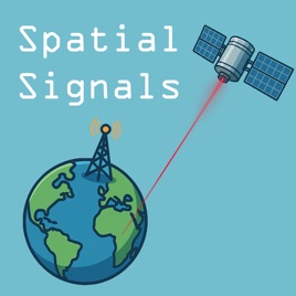
Advertise on podcast: Spatial Signals
Rating
5from
This podcast has
80 episodes
Language
EnglishPublisher
AmericaViewExplicit
No
Date created
2025/04/07
Latest episode
2026/10/12
Average duration
42 min.
Release period
7 days
Description
Spatial Signals is a podcast about remote sensing, GIS, and geospatial technologies - but more importantly it’s a podcast about the people who use and apply them. This podcast is sponsored by AmericaView, the national remote sensing network dedicated to empowering Earth Observation. Your hosts are Dr. Bradley Shellito from Youngstown State University and Mr. Chris McGinty, the Executive Director of AmericaView. New episodes every Monday morning.
Unlock Spatial Signals podcast Email contact info,
Listeners & Audience details
Email contact information
Direct podcast contact details

Listeners
Audience numbers & engagement insights

Audience details
Podcast Insights

Podcast episodes
Check latest episodes from Spatial Signals podcast
The Drone Rangers with Tracy Shane
2026/10/12
Tracy Shane from the University of Nevada-Reno joins us to talk about her backpacking trips with her grandmother as a kid, learning to read topo maps at age seven, the Nevada Youth Range Camp, Tracy’s time as a Student Conservation Employment Program (SCEP) student, the Society for Range Management, the Drone Rangers, a drone named Betty White, working with drones in outreach and a 4-H program, range management, the use of virtual fencing in ranching, the scale of the Great Basin, hyperspectral analysis with drones for biomass estimation, and pairing drone data with NAIP imagery. Show notes and photos are available at: https://americaview.substack.com
The Whole World Was Flat with Yuting Zhou
2026/10/05
Yuting Zhou from Oklahoma State University joins us to talk about a long trip where flat land turned into mountains, tools for understanding landscape changes, studying ecology and agriculture applications, Yuting’s journey from China to Oklahoma, OklahomaView and the national network of AmericaView, the climate and agriculture of Oklahoma, studying agriculture at different scales, UAS filling the gap between satellite data and in situ measurements, invasive species detection with UAS, Red Cedar mapping, GIS Day in Oklahoma, flash drought analysis, and much more. Show notes and photos are available at: https://americaview.substack.com
Married Into Remote Sensing with Jan Eitel
2026/09/28
Jan Eitel from the University of Idaho joins us to talk about going from plot scale to landscape scale, the McCall Outdoor Science School, introducing K-12 students to lidar measurements, STELLA, teaching outdoors and winter research, IdahoView, engaging students in data collection, point dendrometers, a Tree EKG, NISAR imagery and analyzing plant water status, data fusion, AI and extracting meaningful information regarding forest growth and forest health, the response of forest ecosystems to hotter and dryer conditions, lidar and forest management, and much more. Show notes and photos are available at: https://americaview.substack.com
From The Family Business with Paige Williams
2026/09/21
Paige Williams from Virginia Commonwealth University joins us to talk about traveling to the Esri conference in San Diego with her mom while in high school, being inspired by Will.i.am, working in software distribution, maxing out on GIS classes, collecting data and mapping as part of a water study team in Burkina Fasa, flying drones in research at NASA Goddard, forestry analysis at spatial and temporal scales, and Paige’s work at VCU, a student-driven drone class, teacher training with UAS, hands-on learning, working with STELLA and using STELLA on a drone, and much more. Show notes and photos are available at: https://americaview.substack.com
The iPhonification of Data Storage with John Millard
2026/09/14
John Millard from Miami University joins us to talk about the career of Keanu Reeves, becoming a librarian from a business program, technology based jobs for librarians, Dad Lore, Mosaic, building your own digital library of information, a collaboration that would become OhioView, licensing of Landsat data, the cost of data storage, OhioLink and the process of satellite imagery transfer, technology training for librarians, metadata, data storage, the first file cabinet, how AI is changing the game, AI deriving meaning out of disparate data, award winning chili recipes, and much more. Show notes and photos are available at: https://americaview.substack.com
The Thing That Happened Was Landsat with Mary O'Neill
2026/09/07
Mary O’Neill from South Dakota State University joins us to talk about a work study job in the plant science department, the Remote Sensing Institute (RSI) at SDSU, remote sensing from a retrofitted WW2 aircraft, SADE (Signal Analysis and Dissemination Equipment), watching the first scenes from ERTS / Landsat 1 come off the printer, Mary’s participation at the start of AmericaView and her time with the consortium, the establishment of a Geospatial Science Center of Excellence, workshops for K-12 teachers, why EROS was established where it was, Mary’s second retirement, SouthDakotaView, and much more. Show notes and photos are available at: https://americaview.substack.com
That Data Layer Sandwich with Mike Taylor
2026/08/31
Mike Taylor from NASA’s Landsat Project Science Support Team joins us to talk about job fields merging computers and the outdoors, a life-changing 14-day geography field study course, the work of the Landsat Science Team, continuity of Landsat imagery, levels of imagery resolution, the development of STELLA, applications of STELLA in relation to satellite imagery, approachable and affordable STELLA instrumentation and technology, the democratization of instrumentation, the Landsat 9 launch, geocaching at Lompoc to tell the story of Virginia Norwood, EarthLens, and much more. Show notes and photos are available at: https://americaview.substack.com
Payment For Ecosystem Services with Mary Schorse
2026/08/24
Mary Schorse from the University of Delaware joins us to talk about her background in education and how it connects with geospatial technologies, the expansion of geospatial technologies into a multitude of fields, the Delaware Center for Geographic Education (DCGE), inserting GIS and remote sensing into K-12 lessons, Mary’s collaborations with Tracy DeLiberty, Mary’s work with environmental impact assessment in Trinidad, payment for ecosystem services and applications and issues of scale with that, inserting geospatial technology tools into instructor resources, summer education outreach programs for students, the challenges of working with K-12 students and teachers, dual enrollment courses, and much more. Show notes and photos are available at: https://americaview.substack.com
Map Layouts and Band Combinations with Parinaz Rahimzadeh
2026/08/17
Parinaz Rahimzadeh from the University of Maine joins us to talk about finding GIS and remote sensing on her first day of university, creating map layouts and band combinations, Parinaz earning her doctorate in Japan, and the birth of MaineView, forest health, detecting the severity of pathogen-induced damage on the landscape, forest susceptibility, applied research with GIS and remote sensing, pest monitoring, defoliation detection, the abundance of forests in Maine, worksforce training for GIS and remote sensing forest health monitoring, creating products for decision making, and much more. Show notes and photos are available at: https://americaview.substack.com
Teaching GIS - The Squared Circle, Round Five
2026/08/10
This is Round Five of our special “Squared Circle” episodes, where a group of guests gets together to wrestle with a particular topic. For this episode, we're joined by Ms. Robbyn Abbitt from Miami University, Dr. Forrest Bowlick from University of Massachusetts Amherst, and Dr. Courtney Poirier Chicola from the University of Louisiana at Lafayette, and we’re discussing all things about teaching GIS today. We talk about approaches to teaching GIS, mixing fundamentals and application, students working on local projects, producing tangible products, incorporating topoquads and remote sensing, students taking on different roles in projects, relevancy of tasks, incorporating maps from current events, the challenges of online GIS courses, showing why things are happening, collaboration on GIS problems, fundamental changes in what’s been taught in GIS courses, data handling challenges, GeoAI, and much more. Show notes and photos are available at: https://americaview.substack.com
Breaking The Law of Gravity with Jason Lorenzon
2026/08/03
Jason Lorenzon from Kent State University joins us to talk about his wanting to be a pilot from an early age, sneaking to the Windsor airport to get a private pilot license, Jason's training as a concert pianist, teaching aviation law, leading the UAS program at Kent State, training both manned and unmanned aircraft pilots, the NTSB and the definition of an aircraft, the 100th anniversary of the Air Commerce Act of 1926, Bessie Coleman and barnstormers, aircraft regulations, the tiny percentage of people who have actually touched aircraft controls, never losing the awe of flying after takeoff, the intersection of aviation and geospatial technologies, a dynamic Earth, the development of laws related to UAS, the usage of drones by first responders, air taxis, collaboration and cooperation with aviation and remote sensing, national airspace and geospatial technology, and much more. Show notes and photos are available at: https://americaview.substack.com
Russ and Kass' Excellent Adventure with Russ Congalton and Kass Green
2026/07/27
Russ Congalton from the University of New Hampshire and Kass Green from Kass Green and Associates return to talk about how they briefly met a first time, a second meeting at the first national GIS conference, Russ’ heading up the next GIS conference in San Francisco, Russ working with Kass on mapping old growth forest with Landsat imagery, the partnership of practical ideas and new technologies, the critical importance of quantitative accuracy assessment, the impact of Chernobyl on remote sensing, co-authoring two books, CART analysis, Cluster Magic, both Russ and Kass’ serving as ASPRS Presidents, an attempt to hire Robin Williams to entertain at a banquet, both Russ and Kass being recipients of the William T. Pecora award, and much more. Show notes and photos are available at: https://americaview.substack.com/.
The Author Is Always The Last One To Know with Aaron Maxwell
2026/07/20
Aaron Maxwell from West Virginia University returns to talk about his first book in supervised learning being publishing, where the book’s concept came from, Aaron’s co-authors, the whole writing process behind the book, designing figures and graphs, visual design, how Aaron learned about the book’s release, the storytelling of science, the supervised learning process being more spatial, advice for future authors, having passion for the topic, the development of a companion e-book, R, the tinymodels framework, and much more. Show notes and photos are available at: https://americaview.substack.com/.
No Escape From Geology with Umesh Haritashya
2026/07/13
Umesh Haritashya from the University of Dayton joins us to talk about trying to major in zoology and ending up in geology instead, then trying to get into petroleum and ending up in remote sensing instead, ASTER data evaluation and the Global Land Ice Measurement from Space project, glacier datasets that paved the way for modern geospatial studies of the cryosphere, research in Nepal, the long trek to Lake Imja, the advantages of learning through field work, studying changes to glaciers in relation to climate, the impact of glaciers on freshwater resources, the effects of melting glaciers, using DEMs and field measurements for measuring glacial changes, scenario modeling of lake outburst floods, machine learning applications, and much more. Show notes and photos are available at: https://americaview.substack.com
Surrounded By Maps with Morgan Crowley
2026/07/06
Morgan Crowley from the Great Lakes Forestry Centre joins us to talk about growing up with maps and aerial images, Russ Congalton’s mentorship of Morgan at the University of New Hampshire, Ladies of Landsat, WildFireSat, fire monitoring, Canadian wildfires, Morgan’s co-editing a book on Google Earth Engine, deep learning models, trusting data, using remote sensing data for fire management and monitoring, science outreach, knowledge exchange, and much more. Show notes and photos are available at: https://americaview.substack.com
Podcast reviews
Read Spatial Signals podcast reviews
Eunuch Mastersons 2026/04/11
Good for GIS students
As someone earning their GIS certificate, this is a good way to learn about possible careers and applications of the skills I'm learning.
Podcast sponsorship advertising
Start advertising on Spatial Signals relevant audience podcasts
You may also like to advertise on these Podcasts
4.76754463
Criminology
Emash Digital & Mike Ferguson, Mike Morford
4.87505975
The Dr. John Delony Show
Ramsey Network
4.512595664
RedHanded
RedHanded
4.858201918
Sara Gonzales Unfiltered
Blaze Podcast Network
4.922682003
First15 Devotional
First15
4.861421104
The David Pakman Show
David Pakman
4.917101555
DarrenDaily On-Demand
Darren Hardy LLC
4.7106622000
FantasyPros - Fantasy Football Podcast
iHeartPodcasts
4.818392000
The Cabral Concept
Dr. Stephen Cabral
4.9247801444
Unashamed with the Robertson Family
Tread Lively